
1966 Map of Smithville
USGS Topo · Published 1967About this map
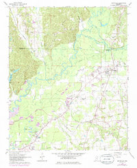
The Tombigbee River snakes through the center of this landscape, its tight meanders defining the border between hilly forested terrain and the flatter, developed plains to the east. This mid-1960s survey captures the area around Smithville and the northern reaches of Amory, revealing a region shaped by its waterways and historical demarcations. The Old Indian Boundary and Treaty Indian Boundary cut across the southern half of the quadrangle, serving as long-standing markers of land division. Scattered rural life is evident in the numerous country churches and graveyards, such as Emmaus Ch and New Chapel Cem, while the local economy is punctuated by several Gravel Pits and a Drive-in Theater. To the north, the small community of Carolina sits near the confluence of Boguegaba Creek and the river, anchored by landmarks like Conwill Cem.
Find a feature on this map
42 named features on this map. Tap any name to fly to it.
Don’t see what you’re looking for? This feature index may not catch every label — zoom into the map to look around manually.
Map Details
Editions of this 1966 Smithville Map
2 editions found
Other maps of this area

1953 · West Point
USGS Topo · 1:250,000

1956 · Tupelo
USGS Topo · 1:250,000

1958 · Tupelo
USGS Topo · 1:250,000

1958 · West Point
USGS Topo · 1:250,000

1963 · West Point
USGS Topo · 1:250,000

1966 · Beans Ferry
USGS Topo · 1:24,000

1966 · Amory
USGS Topo · 1:24,000

1966 · Turon
USGS Topo · 1:24,000

1966 · Wren
USGS Topo · 1:24,000
1966 · Nettleton
USGS Topo · 1:24,000