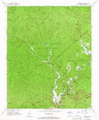
1964 Map of Smokemont
USGS Topo · Published 1966About this map
Smokemont serves as a central point of activity within the Great Smoky Mountains National Park and the Cherokee Indian Reservation, situated where the Bradley Fork meets the Oconaluftee River. The landscape is defined by its deep spiritual and ancestral ties, evidenced by numerous family and community burial grounds such as the Slave Cem, Sequoyah Cem, and Nations Cem.
Find a feature on this map
92 named features on this map. Tap any name to fly to it.
Don’t see what you’re looking for? This feature index may not catch every label — zoom into the map to look around manually.
Map Details
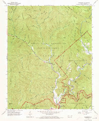
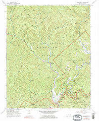
Editions of this 1964 Smokemont Map
4 editions found

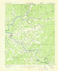
Other maps of this area

1891 · Cowee
USGS Topo · 1:125,000

1893 · Mt Guyot
USGS Topo · 1:125,000

1897 · Cowee
USGS Topo · 1:125,000

1907 · Cowee
USGS Topo · 1:125,000

1912 · Mt Guyot
USGS Topo · 1:125,000

1933 · Bryson
USGS Topo · 1:62,500

1935 · Addie
USGS Topo · 1:24,000

1936 · Bunches Bald
USGS Topo · 1:24,000
1936 · Whittier
USGS Topo · 1:24,000

1936 · Bryson
USGS Topo · 1:24,000
Featured Places
- Birdtown Community, NC
- Painttown Community, NC
- Ravensford, Yellowhill Community
- Wolftown Community, NC
- Big Cove, Big Cove Community