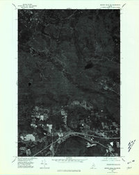
1975 Map of Smyrna Mills NE
USGS Topo · Published 1980About this map
Smyrna Center and Ludlow define the settled southern corridor of this Aroostook County landscape, where agricultural clearings sharply contrast with the dense timberlands to the north. Created from aerial photography captured in 1975, this orthophotoquad provides a literal photographic record of the terrain as it existed during the mid-1970s. The northern portion of the map is dominated by the heavily forested slopes of Bull Ridge, showing few signs of development compared to the southern farmsteads. Water features such as Cochrane Lake and the winding course of Mill Brook are clearly visible through the vegetation, offering researchers a precise view of the hydrology and land-use patterns before modern reforestation or further development altered these rural Maine communities.
Find a feature on this map
5 named features on this map. Tap any name to fly to it.
Don’t see what you’re looking for? This feature index may not catch every label — zoom into the map to look around manually.
Map Details
Editions of this 1975 Smyrna Mills NE Map
This is the sole edition of this map. No revisions or reprints were ever made.
Other maps of this area

1934 · Bridgewater
USGS Topo · 1:48,000

1935 · Howe Brook
USGS Topo · 1:48,000

1937 · Smyrna Mills
USGS Topo · 1:62,500

1938 · Bridgewater
USGS Topo · 1:62,500

1938 · Houlton
USGS Topo · 1:62,500

1939 · Howe Brook
USGS Topo · 1:62,500

1951 · Houlton
USGS Topo · 1:62,500

1951 · Bridgewater
USGS Topo · 1:62,500

1953 · Bridgewater
USGS Topo · 1:50,000

1954 · Howe Brook
USGS Topo · 1:62,500