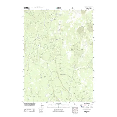
2012 Map of Snag Hill
USGS Topo · Published 2012About this map
Lava Crack Spring and the surrounding volcanic terrain of Siskiyou County are the focus of this 2012 survey. The landscape is defined by elevated landforms including Snag Hill, Papoose Hill, and Powder Hill, as well as the prominent ridge of Chippy Spur. The network of travel through this region is largely defined by US Forest Service routes and unpaved roads, primarily Medicine Lake Rd and Davis Rd. While there are no established settlements on this sheet, the complex web of numbered forest routes like Forest Rte 13 and Forest Rte 40 indicates a landscape managed for timber and resource access rather than residential development. This modern topographic record captures the area's geological features and the intricate infrastructure required for navigating the high-country terrain of Northern California.
Find a feature on this map
51 named features on this map. Tap any name to fly to it.
Don’t see what you’re looking for? This feature index may not catch every label — zoom into the map to look around manually.
Map Details
Editions of this 2012 Snag Hill Map
This is the sole edition of this map. No revisions or reprints were ever made.
Other maps of this area

1886 · Modoc Lava Bed
USGS Topo · 1:250,000

1892 · Modoc Lava-Bed
USGS Topo · 1:250,000

1932 · Bartle
USGS Topo · 1:96,000

1939 · Bartle
USGS Topo · 1:125,000

1950 · Bray
USGS Topo · 1:62,500

1952 · Medicine Lake
USGS Topo · 1:62,500

1954 · Alturas
USGS Topo · 1:250,000

1958 · Alturas
USGS Topo · 1:250,000

1961 · Hambone
USGS Topo · 1:62,500

1961 · Bartle
USGS Topo · 1:62,500