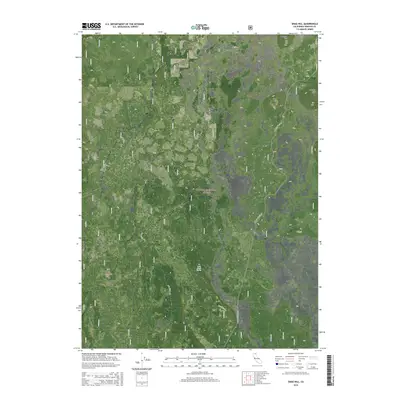
2015 Map of Snag Hill
USGS Topo · Published 2015About this map
Ice Caves and high-elevation volcanic features define this 2015 survey of the northern Cascades landscape. Located within the Shasta National Forest, the terrain is marked by distinctive geological formations such as Obsidian and the prominent Ice River Ridge. The network of Forest Service roads, including Powder Hill (FA49), provides access to a series of summits including Snag Hill, Papoose Hill, and Harris Mtn. Water is scarce in this porous volcanic environment, represented here by Lava Creek Spring and the Lava Crack Spr trail or road. The map captures a modern view of this protected wilderness, showing the intersection of Township and Range boundaries across a landscape shaped by ancient lava flows and subterranean ice formations.
Find a feature on this map
15 named features on this map. Tap any name to fly to it.
Don’t see what you’re looking for? This feature index may not catch every label — zoom into the map to look around manually.
Map Details
Editions of this 2015 Snag Hill Map
This is the sole edition of this map. No revisions or reprints were ever made.
Other maps of this area

1886 · Modoc Lava Bed
USGS Topo · 1:250,000

1892 · Modoc Lava-Bed
USGS Topo · 1:250,000

1932 · Bartle
USGS Topo · 1:96,000

1939 · Bartle
USGS Topo · 1:125,000

1950 · Bray
USGS Topo · 1:62,500

1952 · Medicine Lake
USGS Topo · 1:62,500

1954 · Alturas
USGS Topo · 1:250,000

1958 · Alturas
USGS Topo · 1:250,000

1961 · Hambone
USGS Topo · 1:62,500

1961 · Bartle
USGS Topo · 1:62,500