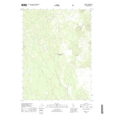
2018 Map of Snag Hill
USGS Topo · Published 2018About this map
Shasta National Forest encompasses this high-elevation landscape in Siskiyou County, dominated by volcanic terrain and forest service corridors. The topography is defined by prominent rises such as Snag Hill and Papoose Hill, alongside the aptly named Powder Hill. A network of specialized routes, including Ice River Ridge and Powder Hill (FA49), suggests a landscape managed for timber and resource access rather than permanent settlement. Of particular interest to those studying local hydrology or geology is Lava Crack Spring, which sits near the namesake Lava Crack Spr road, highlighting the distinct volcanic formations of the region. The map also includes Harris Mtn and the Obsidian route, providing a detailed look at this wilderness area as it appeared in the late 2010s.
Find a feature on this map
16 named features on this map. Tap any name to fly to it.
Don’t see what you’re looking for? This feature index may not catch every label — zoom into the map to look around manually.
Map Details
Editions of this 2018 Snag Hill Map
This is the sole edition of this map. No revisions or reprints were ever made.
Other maps of this area

1886 · Modoc Lava Bed
USGS Topo · 1:250,000

1892 · Modoc Lava-Bed
USGS Topo · 1:250,000

1932 · Bartle
USGS Topo · 1:96,000

1939 · Bartle
USGS Topo · 1:125,000

1950 · Bray
USGS Topo · 1:62,500

1952 · Medicine Lake
USGS Topo · 1:62,500

1954 · Alturas
USGS Topo · 1:250,000

1958 · Alturas
USGS Topo · 1:250,000

1961 · Hambone
USGS Topo · 1:62,500

1961 · Bartle
USGS Topo · 1:62,500