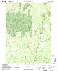
1998 Map of Snag Hill
USGS Topo · Published 2003About this map
Subterranean geological features define this high-elevation landscape within the Shasta-Trinity National Forests during the late 1990s. The map highlights the unique volcanic topography of the region, specifically marking the Water Caves in the northeast and the Ice River Caves near Chippy Spur further south. These landmarks, along with hydrology points like Lava Crack Spring and Lost Iron Well, suggest a terrain shaped by lava flows and volcanic activity rather than standard erosion.
Find a feature on this map
13 named features on this map. Tap any name to fly to it.
Don’t see what you’re looking for? This feature index may not catch every label — zoom into the map to look around manually.
Map Details
Editions of this 1998 Snag Hill Map
This is the sole edition of this map. No revisions or reprints were ever made.
Other maps of this area

1886 · Modoc Lava Bed
USGS Topo · 1:250,000

1892 · Modoc Lava-Bed
USGS Topo · 1:250,000

1932 · Bartle
USGS Topo · 1:96,000

1939 · Bartle
USGS Topo · 1:125,000

1950 · Bray
USGS Topo · 1:62,500

1952 · Medicine Lake
USGS Topo · 1:62,500

1954 · Alturas
USGS Topo · 1:250,000

1958 · Alturas
USGS Topo · 1:250,000

1961 · Hambone
USGS Topo · 1:62,500

1961 · Bartle
USGS Topo · 1:62,500