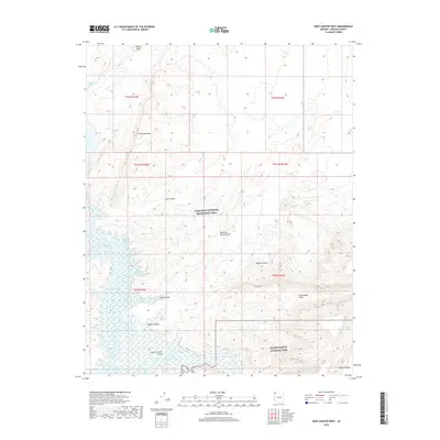
2018 Map of Snap Canyon West
USGS Topo · Published 2018About this map
Lake Mead and the Colorado River dominate the southwestern portion of this 2018 survey, where the river transitions through the Lower Granite Gorge near the Pearce Ferry Rapid. The landscape is a study in desert topography, defined by the towering Grand Wash Cliffs and the elevated Sanup Plateau. This map highlights the meeting point of significant protected lands, including Grand Canyon National Park and the Lake Mead National Recreation Area.
Find a feature on this map
26 named features on this map. Tap any name to fly to it.
Don’t see what you’re looking for? This feature index may not catch every label — zoom into the map to look around manually.
Map Details
Editions of this 2018 Snap Canyon West Map
This is the sole edition of this map. No revisions or reprints were ever made.
Other maps of this area

1886 · Saint Thomas
USGS Topo · 1:250,000

1886 · Mt. Trumbull
USGS Topo · 1:250,000

1892 · Mt. Trumbull
USGS Topo · 1:250,000

1893 · Saint Thomas
USGS Topo · 1:250,000

1926 · Bonelli
USGS Topo · 1:96,000

1953 · Iceberg Canyon
USGS Topo · 1:62,500

1953 · Gold Butte
USGS Topo · 1:62,500

1953 · Grand Canyon
USGS Topo · 1:250,000

1954 · Las Vegas
USGS Topo · 1:250,000

1957 · Las Vegas
USGS Topo · 1:250,000