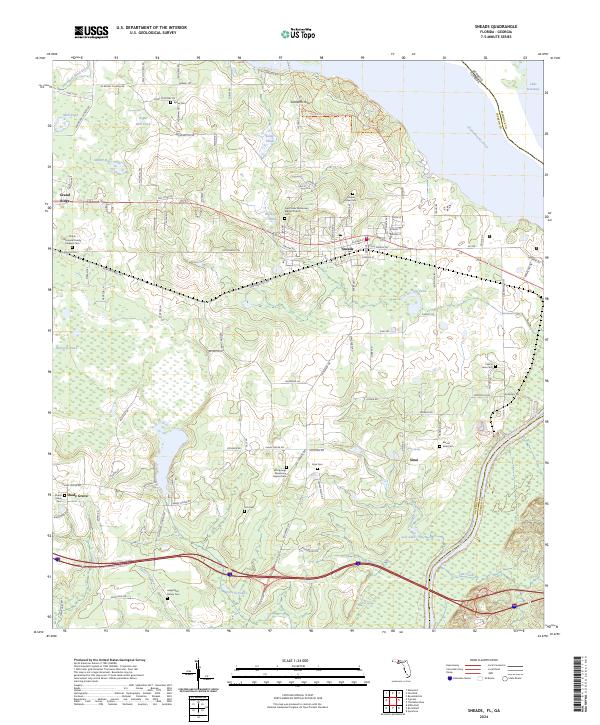
2024 Map of Sneads
USGS Topo · Published 2024About this map
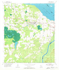
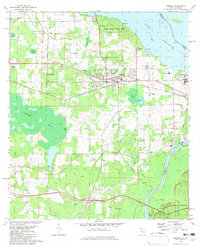
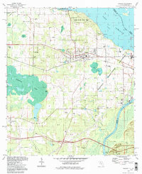
The Chattahoochee River and the expansive Lake Seminole define the eastern and northern borders of this Jackson County landscape. The town of Sneads serves as a central hub, where the Old Spanish Trl and Old US 90 Ln intersect a network of local roads such as Section Ave and Cemetery Ave. To the west, the settlement of Grand Ridge is surrounded by family-named landmarks and numerous small bodies of water like Sugar Mill Pond and Kemp Pond. Local history is preserved in several rural burial grounds, including the Sneads Pope Cem and the Angel Rest Family Cem. The terrain rises to Sixteenth Hill near the Georgia-Florida state line, while the southern reaches transition into the wetland environments of July Lake and Flat Creek. This modern survey documents the current distribution of agriculture and protected lands within Three Rivers State Park (pt) and the Farm Service Agency Interest of Florida.
Find a feature on this map
118 named features on this map. Tap any name to fly to it.
Don’t see what you’re looking for? This feature index may not catch every label — zoom into the map to look around manually.
Map Details
Editions of this 2024 Sneads Map
This is the sole edition of this map. No revisions or reprints were ever made.
Historical Maps of Ocheesee Gardens Through Time
4 maps found