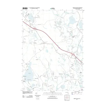
2012 Map of Snipatuit Pond
USGS Topo · Published 2012About this map
The Weweantic River and E Br Sippican River drainage basins define this portion of Plymouth County, characterized by a complex network of reservoirs and bogs used for agriculture and water management. Clusters of development like South Middleboro and Tremont are interconnected by rural corridors, while specialized recreational and aviation sites such as Camp Avoda, Camp Yomechas, and the Bulljump Airport are found throughout the landscape. To the south, the Island Air Service Seaplane Base on Tispaquin Pond highlights the region's reliance on its interior water bodies. The presence of numerous family-named corners and groves, such as Bisbee Corner, Douglas Corner, and Gibbs Grove, reflects a long-standing pattern of localized settlement. The southern reaches are anchored by South Wareham, where the terrain transitions toward coastal lowlands marked by Blackmore Pond and Horseshoe Pond.
Find a feature on this map
153 named features on this map. Tap any name to fly to it.
Don’t see what you’re looking for? This feature index may not catch every label — zoom into the map to look around manually.
Map Details
Editions of this 2012 Snipatuit Pond Map
This is the sole edition of this map. No revisions or reprints were ever made.
Other maps of this area

1885 · New Bedford
USGS Topo · 1:62,500

1885 · Middleboro
USGS Topo · 1:62,500

1886 · Falmouth
USGS Topo · 1:62,500

1886 · Plymouth
USGS Topo · 1:62,500

1888 · New Bedford
USGS Topo · 1:62,500

1888 · Falmouth
USGS Topo · 1:62,500

1888 · Middleboro
USGS Topo · 1:62,500

1889 · Plymouth
USGS Topo · 1:62,500

1893 · Middleboro
USGS Topo · 1:62,500

1893 · Falmouth
USGS Topo · 1:62,500