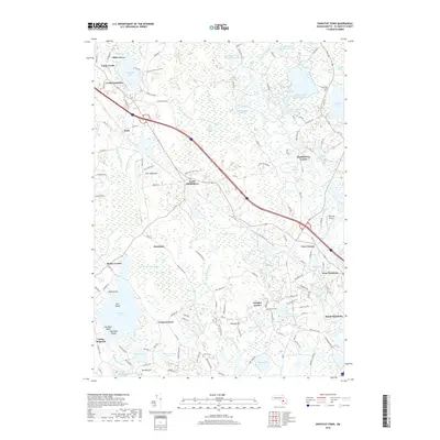
2018 Map of Snipatuit Pond
USGS Topo · Published 2018About this map
Snipatuit Pond and its surrounding wetlands define the lower Plymouth County landscape, where the agricultural legacy of cranberry production is evident in names like Beaton Pond Bogs and the Cross Street Bog Reservoir. This 2018 survey reveals a mosaic of water management systems, including the Atwood Upper Reservoir and Double Brook Reservoir, which feed into the Weweantic River and W Br Sippican River. Local centers such as South Middleboro and West Wareham anchor the area, while smaller family-named landmarks like Cowen Corner, Bisbee Corner, and Douglas Corner mark the intersections of rural life.
Find a feature on this map
140 named features on this map. Tap any name to fly to it.
Don’t see what you’re looking for? This feature index may not catch every label — zoom into the map to look around manually.
Map Details
Editions of this 2018 Snipatuit Pond Map
This is the sole edition of this map. No revisions or reprints were ever made.
Other maps of this area

1885 · New Bedford
USGS Topo · 1:62,500

1885 · Middleboro
USGS Topo · 1:62,500

1886 · Falmouth
USGS Topo · 1:62,500

1886 · Plymouth
USGS Topo · 1:62,500

1888 · New Bedford
USGS Topo · 1:62,500

1888 · Falmouth
USGS Topo · 1:62,500

1888 · Middleboro
USGS Topo · 1:62,500

1889 · Plymouth
USGS Topo · 1:62,500

1893 · Middleboro
USGS Topo · 1:62,500

1893 · Falmouth
USGS Topo · 1:62,500