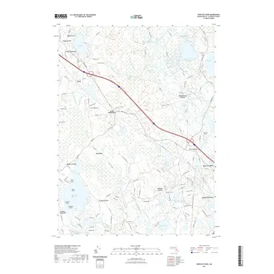
2021 Map of Snipatuit Pond
USGS Topo · Published 2021About this map
Atwood Bogs and Benson Point Bogs reflect the agricultural heritage of this Plymouth County landscape, where the production of cranberries and wetland management has long shaped the local economy. The terrain is characterized by a complex network of reservoirs and swamps, including the Rocky Meadow Brook Reservoir and the South Purchase Swamp, which feed into the Weweantic River and E Br Sippican River. Settled crossroads like Huckleberry Corner, Douglas Corner, and Five Corners anchor the rural road network, while recreational history is evident in the presence of Camp Avoda and Camp Yomechas near Tispaquin Pond. Local history and genealogy are preserved at sites like Union Cem and Hillside Cem, situated amidst the undulating geography of Fearing Hill and Vaughn Hill.
Find a feature on this map
148 named features on this map. Tap any name to fly to it.
Don’t see what you’re looking for? This feature index may not catch every label — zoom into the map to look around manually.
Map Details
Editions of this 2021 Snipatuit Pond Map
This is the sole edition of this map. No revisions or reprints were ever made.
Other maps of this area

1885 · New Bedford
USGS Topo · 1:62,500

1885 · Middleboro
USGS Topo · 1:62,500

1886 · Falmouth
USGS Topo · 1:62,500

1886 · Plymouth
USGS Topo · 1:62,500

1888 · New Bedford
USGS Topo · 1:62,500

1888 · Falmouth
USGS Topo · 1:62,500

1888 · Middleboro
USGS Topo · 1:62,500

1889 · Plymouth
USGS Topo · 1:62,500

1893 · Middleboro
USGS Topo · 1:62,500

1893 · Falmouth
USGS Topo · 1:62,500