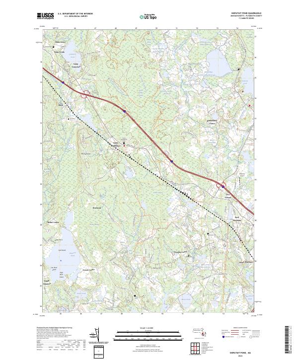
2024 Map of Snipatuit Pond
USGS Topo · Published 2024About this map
Snipatuit Pond and its surrounding wetlands form the heart of this Plymouth County landscape, where the East Branch Sippican River and West Branch Sippican River wind through extensive bog systems. The map illustrates a region deeply connected to the cranberry industry, visible in the numerous reservoirs and specialized water management features like the Atwood Upper Reservoir and Benson Pond Bogs. These industrial waterworks are interspersed with historical crossroads settlements such as Five Corners, South Middleboro, and Rock. Genealogy researchers will find several well-defined burial grounds, including Fall Brook Cem, Rock Cem, and Hillside Cem, which mark the centers of early rural communities. Modern landmarks like Bulljump Airport and seasonal sites like Camp Avoda and Camp Yomechas further define the local character, showing the area's evolution from a purely agricultural and bog-iron landscape into a contemporary mixture of conservation lands and small-town residential hubs.
Find a feature on this map
150 named features on this map. Tap any name to fly to it.
Don’t see what you’re looking for? This feature index may not catch every label — zoom into the map to look around manually.
Map Details
Editions of this 2024 Snipatuit Pond Map
This is the sole edition of this map. No revisions or reprints were ever made.
Other maps of this area

1885 · New Bedford
USGS Topo · 1:62,500

1885 · Middleboro
USGS Topo · 1:62,500

1886 · Falmouth
USGS Topo · 1:62,500

1886 · Plymouth
USGS Topo · 1:62,500

1888 · New Bedford
USGS Topo · 1:62,500

1888 · Falmouth
USGS Topo · 1:62,500

1888 · Middleboro
USGS Topo · 1:62,500

1889 · Plymouth
USGS Topo · 1:62,500

1893 · Middleboro
USGS Topo · 1:62,500

1893 · Falmouth
USGS Topo · 1:62,500