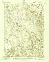
1938 Map of Snipatuit Pond
USGS Topo · Published 1938About this map
Snipatuit Pond and its surrounding wetlands anchor this late 1930s survey of the Massachusetts South Shore interior. The landscape is defined by the intersection of early industry and established rural life, notably shown through the extensive cranberry cultivation at Atwood Bogs and Benson Pond Bogs. The New York New Haven and Hartford railroad cuts through the center of the sheet, serving settlements like Rock Station and South Middleboro.
Find a feature on this map
101 named features on this map. Tap any name to fly to it.
Don’t see what you’re looking for? This feature index may not catch every label — zoom into the map to look around manually.
Map Details
Editions of this 1938 Snipatuit Pond Map
This is the sole edition of this map. No revisions or reprints were ever made.
Other maps of this area

1885 · New Bedford
USGS Topo · 1:62,500

1885 · Middleboro
USGS Topo · 1:62,500

1886 · Falmouth
USGS Topo · 1:62,500

1886 · Plymouth
USGS Topo · 1:62,500

1888 · New Bedford
USGS Topo · 1:62,500

1888 · Falmouth
USGS Topo · 1:62,500

1888 · Middleboro
USGS Topo · 1:62,500

1889 · Plymouth
USGS Topo · 1:62,500

1893 · Middleboro
USGS Topo · 1:62,500

1893 · Falmouth
USGS Topo · 1:62,500