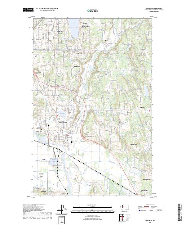
2023 Map of Snohomish
USGS Topo · Published 2023About this map
The Snohomish River floodplain dominates the southern landscape of this Snohomish County survey, where the river winds through agricultural lowlands near Harvey Field. The historic core of Snohomish is defined by a significant concentration of early burial grounds, including the Snohomish Pioneer Cem North and the Grand Army of the Republic Cem, reflecting the city's role as an early regional center. Northward, the elevation rises toward Lake Stevens, with suburban development spreading into Cavalero and West Lake Stevens.
Find a feature on this map
50 named features on this map. Tap any name to fly to it.
Don’t see what you’re looking for? This feature index may not catch every label — zoom into the map to look around manually.
Map Details
Editions of this 2023 Snohomish Map
This is the sole edition of this map. No revisions or reprints were ever made.
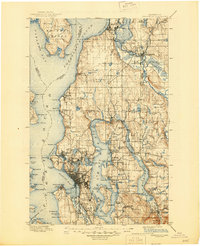
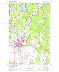
Historical Maps of Machias Through Time
4 maps found