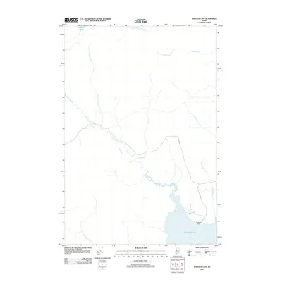
2011 Map of Socatean Bay
USGS Topo · Published 2011About this map
Moosehead Lake defines the southeastern corner of this North Maine Woods landscape, where Socatean Point extends into the water near the mouth of Socatean Stream. The interior terrain is characterized by a dense network of watercourses, including Public Lot Brook and Williams Brook, which flow through the timberlands of Big W Township. The area is largely undeveloped, with human activity centered around the lake shore and a handful of access routes like Socatean Point Rd and Eagle Point Ln.
Find a feature on this map
14 named features on this map. Tap any name to fly to it.
Don’t see what you’re looking for? This feature index may not catch every label — zoom into the map to look around manually.
Map Details
Editions of this 2011 Socatean Bay Map
This is the sole edition of this map. No revisions or reprints were ever made.
Other maps of this area

1920 · Moosehead Lake
USGS Topo · 1:62,500

1921 · Brassua Lake
USGS Topo · 1:62,500

1922 · Moosehead Lake
USGS Topo · 1:62,500

1923 · Brassua Lake
USGS Topo · 1:62,500

1930 · Moosehead Lake
USGS Topo · 1:62,500

1944 · Brassua Lake
USGS Topo · 1:62,500

1944 · Moosehead Lake
USGS Topo · 1:62,500

1954 · Seboomook Lake
USGS Topo · 1:62,500

1954 · North East Carry
USGS Topo · 1:62,500

1954 · Millinocket
USGS Topo · 1:250,000
Featured Places
- Big W Township, ME
- West Middlesex Canal Grant Township, ME
- Tomhegan Township, ME
- Plymouth Township, ME
- Seboomook Township, ME