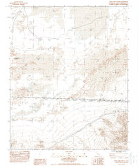
1983 Map of Soda Lake South
USGS Topo · Published 1987About this map
The arid desert floor of the Mojave dominates this 1980s survey, where the ephemeral Soda Lake and Dry Lake define the northern terrain. The landscape is characterized by expansive shifting Sand deposits and the dramatic dunes of the Devils Playground. Human presence is largely confined to the infrastructure corridors of the Union Pacific RR and a large Transmission Line cutting across the southern reaches of the quadrangle.
Find a feature on this map
11 named features on this map. Tap any name to fly to it.
Don’t see what you’re looking for? This feature index may not catch every label — zoom into the map to look around manually.
Map Details
Editions of this 1983 Soda Lake South Map
2 editions found
Other maps of this area

1910 · Ivanpah
USGS Topo · 1:250,000

1912 · Ivanpah
USGS Topo · 1:250,000

1933 · Avawatz Mountains
USGS Topo · 1:250,000

1942 · Ivanpah
USGS Topo · 1:250,000

1942 · Amboy
USGS Topo · 1:250,000

1943 · Amboy
USGS Topo · 1:250,000

1947 · Trona
USGS Topo · 1:250,000

1947 · Kingman
USGS Topo · 1:250,000

1948 · Kingman
USGS Topo · 1:250,000

1948 · Trona
USGS Topo · 1:250,000