
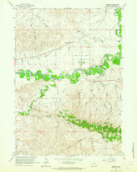
1961 Map of Soldier Creek
USGS Topo · Published 1964About this map
The Bozeman Trail cuts through this high plains landscape, following a historic path of Western migration across Johnson County. In the early 1960s, the area is defined by its deep arroyos and the winding course of the Powder River, which borders the Fort Reno Military Reservation. This intersection of military history and transport routes is marked by significant topographical features such as the Smith Cutoff Anticline, a geological formation that influences the local drainage patterns of Soldier Creek and North Prong. The map reveals a land utilized for water management and resource extraction, shown by several Well and Drill Hole locations alongside ranching infrastructure like Palmer Reservoir and Twomile Reservoir. These developments illustrate the mid-century transition from a strictly frontier passage to an managed pastoral and mineral-producing environment.
Find a feature on this map
19 named features on this map. Tap any name to fly to it.
Don’t see what you’re looking for? This feature index may not catch every label — zoom into the map to look around manually.
Map Details
Editions of this 1961 Soldier Creek Map
This is the sole edition of this map. No revisions or reprints were ever made.
Other maps of this area

1953 · Hoe Ranch
USGS Topo · 1:24,000

1953 · Fort Reno
USGS Topo · 1:24,000

1954 · House Creek
USGS Topo · 1:24,000

1955 · Arminto
USGS Topo · 1:250,000

1958 · Arminto
USGS Topo · 1:250,000

1961 · Fourmile Reservoir
USGS Topo · 1:24,000

1961 · Figure 8 Reservoir
USGS Topo · 1:24,000

1961 · Provence Ranch
USGS Topo · 1:24,000

1961 · Elaine Draw
USGS Topo · 1:24,000
1961 · Sussex
USGS Topo · 1:24,000