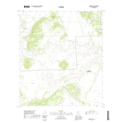
2019 Map of Sombrero Peak
USGS Topo · Published 2019About this map
Big Bend National Park defines the southern half of this Brewster County landscape, where the Chihuahuan Desert meets the northern reaches of the park's protected boundary. The terrain is marked by significant hydrological markers essential for survival in this arid environment, including Indian Spring, Rock House Spring, and the central Onion Spring. These water sources are scattered among prominent elevations such as the Rosillos Mountains in the northeast and the distinctive Sombrero Peak to the north. A network of rural desert roads, such as Terlingua Ranch Rd and Marathon Rd, provides access across the northern plains. The drainage patterns of Tornillo Cr and East Corazones Draw reveal the erosional forces shaping the basin near Onion Flat, while the Paint Gap Hills rise sharply in the southeast, offering a clear view of the transition into the deeper canyons of the park.
Find a feature on this map
20 named features on this map. Tap any name to fly to it.
Don’t see what you’re looking for? This feature index may not catch every label — zoom into the map to look around manually.
Map Details
Editions of this 2019 Sombrero Peak Map
This is the sole edition of this map. No revisions or reprints were ever made.
Other maps of this area

1903 · Chisos Mountains
USGS Topo · 1:125,000

1905 · Chisos Mountains
USGS Topo · 1:125,000

1917 · Bone Spring
USGS Topo · 1:62,500

1918 · Bone Spring
USGS Topo · 1:125,000

1918 · Bone Spring
USGS Topo · 1:62,500

1918 · Nine Point Mesa
USGS Topo · 1:62,500

1920 · Bone Spring
USGS Topo · 1:62,500

1937 · Nine Point Mesa
USGS Topo · 1:62,500

1959 · Emory Peak
USGS Topo · 1:250,000

1965 · Emory Peak
USGS Topo · 1:250,000