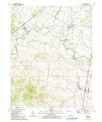
1992 Map of Sonora
USGS Topo · Published 1992About this map
The Nolin River winds through this Hardin County landscape, carving a path between the settlements of Star Mills, Glendale, and Sonora. This 1992 edition illustrates a region defined by its rural road network and deep genealogical roots, visible in the numerous burial grounds like Little Zion Ch Cem and Stone Cem. The transport corridors are well-established, with the Western Kentucky Parkway and the Louisville and Nashville railroad providing essential links to the wider state.
Find a feature on this map
43 named features on this map. Tap any name to fly to it.
Don’t see what you’re looking for? This feature index may not catch every label — zoom into the map to look around manually.
Map Details
Editions of this 1992 Sonora Map
This is the sole edition of this map. No revisions or reprints were ever made.
Other maps of this area

1925 · Cub Run
USGS Topo · 1:62,500

1932 · Big Clifty
USGS Topo · 1:62,500

1934 · Munfordville
USGS Topo · 1:48,000

1935 · Elizabethtown
USGS Topo · 1:48,000

1937 · Munfordville
USGS Topo · 1:62,500

1938 · Elizabethtown
USGS Topo · 1:62,500

1948 · Cecilia
USGS Topo · 1:24,000

1949 · Sonora
USGS Topo · 1:24,000

1949 · Tonieville
USGS Topo · 1:24,000

1949 · Summit
USGS Topo · 1:24,000