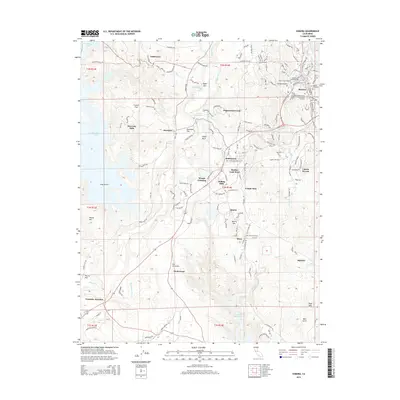
2015 Map of Sonora
USGS Topo · Published 2015About this map
Sonora and its surrounding Sierra Nevada foothills are documented here in a 2015 U.S. Geological Survey study, showing a landscape defined by its mining heritage and historical development. The map details a concentration of early burial grounds, including the Jewish Cemetery, Sonora City Cemetery, and the Independent Order of Oddfellows Cemetery. These sites, clustered near the town center, speak to the diverse community that formed during the gold rush era. Transportation routes such as the Sierra Railroad and highways leading to Yosemite Junction illustrate the region's role as a gateway between the Central Valley and the high mountains. Outside the main settlements of Jamestown and Quartz, the topography features distinctive landforms like the volcanic Table Mtn and the narrow corridor of Dragon Gulch. The persistence of smaller locales like Stent, Montezuma, and Tuttletown alongside newer residential developments like Cuesta Serena highlights the evolving character of Tuolumne County.
Find a feature on this map
186 named features on this map. Tap any name to fly to it.
Don’t see what you’re looking for? This feature index may not catch every label — zoom into the map to look around manually.
Map Details
Editions of this 2015 Sonora Map
This is the sole edition of this map. No revisions or reprints were ever made.
Other maps of this area

1889 · Jackson
USGS Topo · 1:125,000

1891 · Big Trees
USGS Topo · 1:125,000

1892 · Jackson
USGS Topo · 1:125,000

1893 · Sonora
USGS Topo · 1:125,000

1894 · Big Trees
USGS Topo · 1:125,000

1896 · Sonora
USGS Topo · 1:125,000

1897 · Jackson
USGS Topo · 1:125,000

1897 · Sonora
USGS Topo · 1:125,000

1897 · Big Trees
USGS Topo · 1:125,000

1898 · Sonora
USGS Topo · 1:125,000