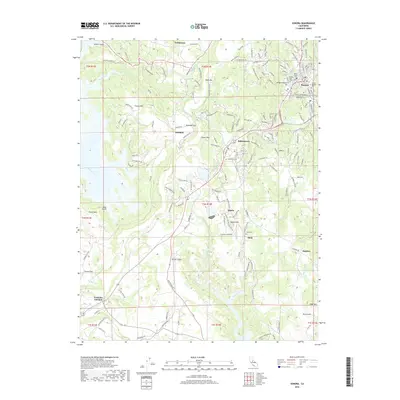
2018 Map of Sonora
USGS Topo · Published 2018About this map
Sonora serves as the focal point of this Mother Lode region survey, characterized by a dense concentration of civic and memorial sites including the Sonora Jewish Cem, Sonora City Cem, and Masonic Cem. The landscape transitions from the developed streets of Jamestown and Quartz into the distinct volcanic geography of Table Mtn and Pulpit Rock. Evidence of historical water management for mining and agriculture is visible through the Algerine Ditch and Shaws Flat Ditch, which wind through the foothills near Algerine.
Find a feature on this map
170 named features on this map. Tap any name to fly to it.
Don’t see what you’re looking for? This feature index may not catch every label — zoom into the map to look around manually.
Map Details
Editions of this 2018 Sonora Map
This is the sole edition of this map. No revisions or reprints were ever made.
Other maps of this area

1889 · Jackson
USGS Topo · 1:125,000

1891 · Big Trees
USGS Topo · 1:125,000

1892 · Jackson
USGS Topo · 1:125,000

1893 · Sonora
USGS Topo · 1:125,000

1894 · Big Trees
USGS Topo · 1:125,000

1896 · Sonora
USGS Topo · 1:125,000

1897 · Jackson
USGS Topo · 1:125,000

1897 · Sonora
USGS Topo · 1:125,000

1897 · Big Trees
USGS Topo · 1:125,000

1898 · Sonora
USGS Topo · 1:125,000