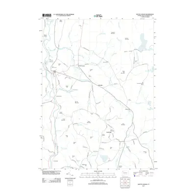
2012 Map of South Canaan
USGS Topo · Published 2012About this map
The Housatonic River and Hollenbeck River systems define the valley floors of this Litchfield County landscape, where the primary settlement of Falls Village is situated along the western edge. This 2012 survey illustrates a region shaped by high terrain and academic heritage, notably featuring the Yale University Forestry School and the protected lands of Canaan Mountain and Bradford Mountain. The distribution of burial grounds, such as Saint Patricks Cem and the Lower City Cem, marks the historical footprint of smaller hamlets like South Canaan and Huntsville. Significant water bodies including Wangum Lake and Cream Hill Lake are prominent landmarks within the elevation shifts of Music Mountain and Stone Man Mountain, providing a comprehensive look at the region's complex drainage through Whiting Brook and Deming Brook.
Find a feature on this map
120 named features on this map. Tap any name to fly to it.
Don’t see what you’re looking for? This feature index may not catch every label — zoom into the map to look around manually.
Map Details
Editions of this 2012 South Canaan Map
This is the sole edition of this map. No revisions or reprints were ever made.
Other maps of this area

1885 · Sheffield
USGS Topo · 1:62,500

1888 · Sheffield
USGS Topo · 1:62,500

1888 · Sandisfield
USGS Topo · 1:62,500

1891 · Sheffield
USGS Topo · 1:62,500

1892 · Winsted
USGS Topo · 1:62,500

1892 · Cornwall
USGS Topo · 1:62,500

1893 · Sheffield
USGS Topo · 1:62,500

1893 · Cornwall
USGS Topo · 1:62,500

1893 · Sandisfield
USGS Topo · 1:62,500

1897 · Sandisfield
USGS Topo · 1:62,500