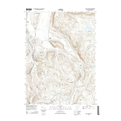
2015 Map of South Canaan
USGS Topo · Published 2015About this map
Falls Village and South Canaan anchor this part of the Litchfield County highlands, where the Housatonic River carves a deep valley between Sharon Mtn and Canaan Mtn. The landscape is defined by its transition from riverbank settlements to high wooded ridges, marked by the path of the Appalachian National Scenic Trail as it crosses Lookout Point and passes near Dean Ravine. The map reveals a high density of small family and community burial grounds, such as Munson Cem and Root Cem, scattered across the uplands near Lower City and Huntsville. This settlement pattern suggests a history of decentralized farming and early industrial hamlets tucked into the hollows. Large water bodies like Wangum Lake and Cream Hill Lake sit atop the plateaus, feeding a network of steep streams including Whiting Brook and the Hollenbeck River that once powered the region's early development.
Find a feature on this map
98 named features on this map. Tap any name to fly to it.
Don’t see what you’re looking for? This feature index may not catch every label — zoom into the map to look around manually.
Map Details
Editions of this 2015 South Canaan Map
This is the sole edition of this map. No revisions or reprints were ever made.
Other maps of this area

1885 · Sheffield
USGS Topo · 1:62,500

1888 · Sheffield
USGS Topo · 1:62,500

1888 · Sandisfield
USGS Topo · 1:62,500

1891 · Sheffield
USGS Topo · 1:62,500

1892 · Winsted
USGS Topo · 1:62,500

1892 · Cornwall
USGS Topo · 1:62,500

1893 · Sheffield
USGS Topo · 1:62,500

1893 · Cornwall
USGS Topo · 1:62,500

1893 · Sandisfield
USGS Topo · 1:62,500

1897 · Sandisfield
USGS Topo · 1:62,500