
1967 Map of South Devon School
USGS Topo · Published 1970About this map
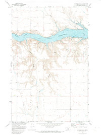
The industrial and agricultural landscape of Toole County in the late 1960s is defined by the east-west passage of the Great Northern railroad and a network of energy infrastructure. The Telstad Pumping Sta and an extensive Pipeline system highlight the importance of the region's utilities, while the South Devon Sch and a nearby Landing Strip anchor the rural community. The terrain is marked by seasonal drainage patterns including Dunkirk Coulee and Dodge Coulee, which cut through the plains toward the West Fork Willow Creek. This survey captures a moment when traditional grain and livestock fencing, noted by fine dashed lines, existed alongside modern developments like the Radio Tower and local resource extraction at the Gravel Pit.
Find a feature on this map
11 named features on this map. Tap any name to fly to it.
Don’t see what you’re looking for? This feature index may not catch every label — zoom into the map to look around manually.
Map Details
Editions of this 1967 South Devon School Map
This is the sole edition of this map. No revisions or reprints were ever made.
Other maps of this area

1920 · Conrad
USGS Topo · 1:125,000

1943 · Antelope Coulee
USGS Topo · 1:62,500

1954 · Shelby
USGS Topo · 1:250,000

1958 · Shelby
USGS Topo · 1:250,000

1962 · Mc Carters Lake
USGS Topo · 1:24,000

1967 · Central School
USGS Topo · 1:24,000

1967 · Conrad Butte
USGS Topo · 1:24,000

1967 · Dunkirk
USGS Topo · 1:24,000

1970 · Devon
USGS Topo · 1:24,000
1970 · Denson Ranch
USGS Topo · 1:24,000