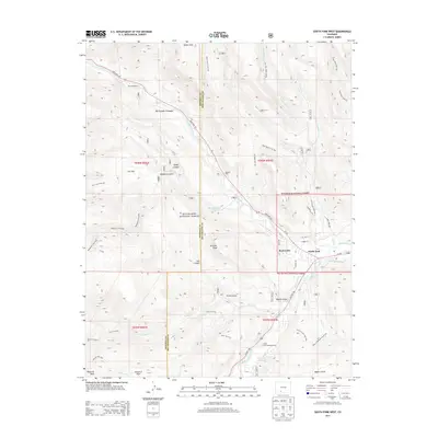
2013 Map of South Fork West
USGS Topo · Published 2013About this map
South Fork sits at the confluence of the Rio Grande and the South Fork Rio Grande, serving as a central hub for this portion of Rio Grande National Forest. The map documents a landscape defined by significant water management and recreational infrastructure, including the S Fork Highline Ditch and Church Ditch, alongside several local retreats like Masonic Park, Riverside Ranch, and South Fork Campgrounds. The steep canyon walls of the Rio Grande Palisades tower over the river valley, while higher elevations are marked by remote landmarks such as Sentinel Peak and Goodrich Peak. A dense network of forest trails, including the Alder Bench Trail 799 and Beaver Mountain Trail 933, crisscrosses the mountainous terrain, linking points like Elk Park and Haney Canyon to the valley floor. This detailed survey captures the intersection of early twentieth-century ranching foundations and modern forest management in the Colorado high country.
Find a feature on this map
55 named features on this map. Tap any name to fly to it.
Don’t see what you’re looking for? This feature index may not catch every label — zoom into the map to look around manually.
Map Details
Editions of this 2013 South Fork West Map
This is the sole edition of this map. No revisions or reprints were ever made.
Other maps of this area

1914 · Creede
USGS Topo · 1:125,000

1916 · Creede
USGS Topo · 1:125,000

1945 · Durango
USGS Topo · 1:250,000

1953 · Durango
USGS Topo · 1:250,000

1954 · Durango
USGS Topo · 1:250,000

1957 · Spar City
USGS Topo · 1:62,500

1959 · Creede
USGS Topo · 1:62,500

1961 · Durango
USGS Topo · 1:250,000

1963 · Durango
USGS Topo · 1:250,000

1966 · Durango
USGS Topo · 1:250,000