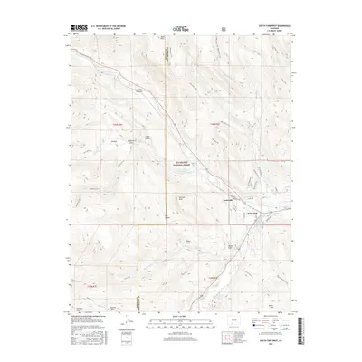
2016 Map of South Fork West
USGS Topo · Published 2016About this map
The confluence of the Rio Grande and the South Fork Rio Grande serves as the focal point for this high-altitude landscape, where mountain terrain meets the burgeoning settlement of South Fork. This 2016 survey highlights a complex network of resource management and recreation within the Rio Grande National Forest, featuring the irrigation infrastructure of the Church Ditch and S Fork Highline Ditch. The map documents a mix of wilderness and development, from the rocky heights of the Rio Grande Palisades and Sentinel Peak to modern residential corridors like Blanca Vista Dr. A dense system of trails, including the Alder Bench Trail and Trout Trail, crisscrosses the topography, revealing how the region’s canyons such as Haney Canyon and Salt Canyon are navigated today. Nearby, the smaller settlement of Baxterville and various water works like the Elk Cr Number 1 Reservoir illustrate the continued importance of water control in this arid river valley.
Find a feature on this map
54 named features on this map. Tap any name to fly to it.
Don’t see what you’re looking for? This feature index may not catch every label — zoom into the map to look around manually.
Map Details
Editions of this 2016 South Fork West Map
This is the sole edition of this map. No revisions or reprints were ever made.
Other maps of this area

1914 · Creede
USGS Topo · 1:125,000

1916 · Creede
USGS Topo · 1:125,000

1945 · Durango
USGS Topo · 1:250,000

1953 · Durango
USGS Topo · 1:250,000

1954 · Durango
USGS Topo · 1:250,000

1957 · Spar City
USGS Topo · 1:62,500

1959 · Creede
USGS Topo · 1:62,500

1961 · Durango
USGS Topo · 1:250,000

1963 · Durango
USGS Topo · 1:250,000

1966 · Durango
USGS Topo · 1:250,000