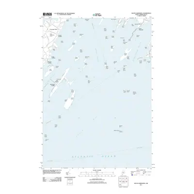
2011 Map of South Harpswell
USGS Topo · Published 2011About this map
Casco Bay and its intricate archipelago of islands are detailed here, reflecting the maritime character of coastal Cumberland County in the early 21st century. The map highlights the significant landmasses of Chebeague Island and Cliff Island, including key water access points such as Central Landing and Cliff Island Landing. The surrounding waters of Luckse Sound and Broad Sound are dotted with numerous small isles and treacherous ledges, including Whaleboat Ledge and Goose Nest Ledge. Navigation is guided by prominent beacons like Halfway Rock Light and Monument Light, which stand watch over the outer reaches of the Atlantic Ocean. This record documents the established road networks of the larger islands, such as S Shore Dr and Island Ave, while preserving the names of remote outcroppings like Junk of Pork and West Brown Cow that have long defined the local nautical geography.
Find a feature on this map
89 named features on this map. Tap any name to fly to it.
Don’t see what you’re looking for? This feature index may not catch every label — zoom into the map to look around manually.
Map Details
Editions of this 2011 South Harpswell Map
This is the sole edition of this map. No revisions or reprints were ever made.
Other maps of this area

1892 · Freeport
USGS Topo · 1:62,500

1893 · Small Point
USGS Topo · 1:62,500

1893 · Casco Bay
USGS Topo · 1:62,500

1894 · Bath
USGS Topo · 1:62,500

1914 · Casco Bay
USGS Topo · 1:48,000

1916 · Casco Bay
USGS Topo · 1:62,500

1916 · Portland And Vicinity
USGS Topo · 1:62,500

1918 · Portland And Vicinity
USGS Topo · 1:62,500

1919 · Small Point
USGS Topo · 1:62,500

1920 · Bath
USGS Topo · 1:62,500