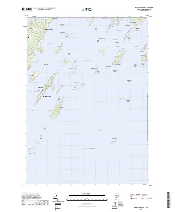
2024 Map of South Harpswell
USGS Topo · Published 2024About this map
Great Chebeague Island and the complex archipelago of Casco Bay define this maritime landscape of Cumberland County. The map details a seafaring environment where the Cliff Island Ferry connects isolated settlements like Cliff Island to the mainland of Portland. Navigation through the Green Island Passage and Luckse Sound is complicated by numerous hazards such as West Brown Cow and Mink Rocks. On the mainland at South Harpswell, the local geography is shaped by protected waters like Potts Harbor and Basin Cove. For genealogists, the map identifies specific burial sites including the Chebeague Island Cem and Graveyard Point Cem. The presence of the Petit Manan National Wildlife Refuge on islands such as Upper Flag Island highlights the preservation of this rugged island chain.
Find a feature on this map
106 named features on this map. Tap any name to fly to it.
Don’t see what you’re looking for? This feature index may not catch every label — zoom into the map to look around manually.
Map Details
Editions of this 2024 South Harpswell Map
This is the sole edition of this map. No revisions or reprints were ever made.
Other maps of this area

1892 · Freeport
USGS Topo · 1:62,500

1893 · Small Point
USGS Topo · 1:62,500

1893 · Casco Bay
USGS Topo · 1:62,500

1894 · Bath
USGS Topo · 1:62,500

1914 · Casco Bay
USGS Topo · 1:48,000

1916 · Casco Bay
USGS Topo · 1:62,500

1916 · Portland And Vicinity
USGS Topo · 1:62,500

1918 · Portland And Vicinity
USGS Topo · 1:62,500

1919 · Small Point
USGS Topo · 1:62,500

1920 · Bath
USGS Topo · 1:62,500