2022 Map of South Mills
USGS Topo · Published 2022About this map
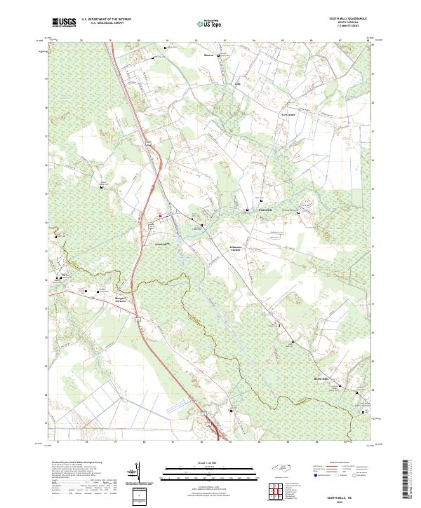
South Mills serves as the focal point of this coastal plain landscape, where the historic Dismal Swamp Canal and the Intracoastal Waterway intersect with the winding Pasquotank River. The map reveals a deeply established rural network defined by family history, evidenced by the numerous small burial grounds such as the Powell Family Cem and Etheridge Cem that dot the countryside. The geography is dominated by the margins of the Great Dismal Swamp, which dictates the placement of settlements like Morgans Corners and Johnsons Corner. Transportation patterns follow the natural levees and ridges, with routes like Pudding Ridge Rd and Old Swamp Rd connecting isolated communities. The distribution of sites like the Bethel AME Zion Church and Sharon Church highlights the longstanding social centers of Camden County and Pasquotank County.
Find a feature on this map
90 named features on this map. Tap any name to fly to it.
Don’t see what you’re looking for? This feature index may not catch every label — zoom into the map to look around manually.
Map Details
Editions of this 2022 South Mills Map
This is the sole edition of this map. No revisions or reprints were ever made.
Historical Maps of Tar Corner Through Time
4 maps found