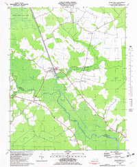
1982 Map of South Mills
USGS Topo · Published 1982About this map
Great Dismal Swamp dominates this landscape, where the heavy vegetation of Dismal Swamp State Park meets the hydraulic engineering of the Dismal Swamp Canal. The settlement of South Mills serves as a focal point for the region's transport network, situated where the canal and the Pasquotank River intersect near Lock No 2 and a distinctive Seawall. The map reveals a community deeply tied to its waterways, with small settlements like Burnt Mills and Pierceville bordering the wetlands.
Find a feature on this map
33 named features on this map. Tap any name to fly to it.
Don’t see what you’re looking for? This feature index may not catch every label — zoom into the map to look around manually.
Map Details
Editions of this 1982 South Mills Map
This is the sole edition of this map. No revisions or reprints were ever made.
Other maps of this area

1939 · Moyock
USGS Topo · 1:62,500

1940 · Lake Drummond
USGS Topo · 1:62,500

1940 · South Mills
USGS Topo · 1:62,500

1945 · Lake Drummond
USGS Topo · 1:62,500

1946 · Moyock
USGS Topo · 1:62,500

1948 · Elizabeth City
USGS Topo · 1:62,500

1952 · South Mills
USGS Topo · 1:62,500

1953 · Norfolk
USGS Topo · 1:250,000
1954 · Lake Drummond
USGS Topo · 1:24,000
1954 · Lake Drummond SE
USGS Topo · 1:24,000