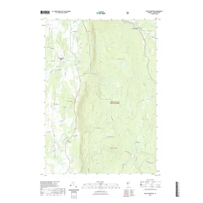
2021 Map of South Mountain
USGS Topo · Published 2021About this map
New Haven Mills sits along the western edge of this territory, where the terrain begins its ascent into the heart of the Green Mountain National Forest. The landscape is defined by the sharp contrast between the valley lowlands of the New Haven River and the high peaks of South Mtn and Robert Frost Mtn. Local family and community history is anchored by several rural burying grounds, including Maple Cem near West Lincoln and the Saint Therese Cem tucked along the eastern slopes. A network of primitive paths, such as the Beaver Meadow Trl and Alphonse Quesnel Trl, provides access into the interior forest and toward high-elevation water sources like Abbey Pond. The map reveals a settlement pattern of small hamlets like Bristol Flats connected by winding roads that follow the natural contours of the Green Mountains.
Find a feature on this map
60 named features on this map. Tap any name to fly to it.
Don’t see what you’re looking for? This feature index may not catch every label — zoom into the map to look around manually.
Map Details
Editions of this 2021 South Mountain Map
This is the sole edition of this map. No revisions or reprints were ever made.
Other maps of this area

1902 · Brandon
USGS Topo · 1:62,500

1903 · Middlebury
USGS Topo · 1:62,500

1904 · Brandon
USGS Topo · 1:62,500

1905 · Middlebury
USGS Topo · 1:62,500

1915 · Rochester
USGS Topo · 1:62,500

1917 · Rochester
USGS Topo · 1:62,500

1919 · Lincoln Mountain
USGS Topo · 1:62,500

1920 · Lincoln Mountain
USGS Topo · 1:48,000

1920 · Brandon
USGS Topo · 1:62,500

1920 · Middlebury
USGS Topo · 1:62,500