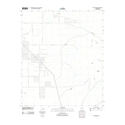
2010 Map of South Peak
USGS Topo · Published 2010About this map
The Florida Mountains dominate this high-desert landscape in Luna County, anchored by the prominent South Peak. Near the mountains' eastern flank, the Shaw Prospect and Mahoney Park mark the intersection of natural terrain and human enterprise. The settlement of White Hills sits to the north, defined by a grid of local roads like Camino Siete and Mahoney Park Rd. This area reflects the typical ranching and mining infrastructure of the region, where water management is critical as evidenced by McBee Windmill and Palayo Tank. To the west, a residential pattern emerges along roads such as Domingues Rd and Peralta Rd, while the Big Pocket-Florida Mountains Area preserves the rugged character of the peaks and deep cuts like Box Canyon.
Find a feature on this map
42 named features on this map. Tap any name to fly to it.
Don’t see what you’re looking for? This feature index may not catch every label — zoom into the map to look around manually.
Map Details
Editions of this 2010 South Peak Map
This is the sole edition of this map. No revisions or reprints were ever made.
Other maps of this area

1899 · Deming
USGS Topo · 1:125,000

1915 · Deming
USGS Topo · 1:125,000

1917 · Hermanas
USGS Topo · 1:62,500

1917 · Columbus
USGS Topo · 1:62,500

1918 · Columbus
USGS Topo · 1:62,500

1918 · Hermanas
USGS Topo · 1:62,500

1920 · Columbus
USGS Topo · 1:62,500

1943 · Hermanas
USGS Topo · 1:62,500

1953 · El Paso
USGS Topo · 1:250,000

1955 · Las Cruces
USGS Topo · 1:250,000