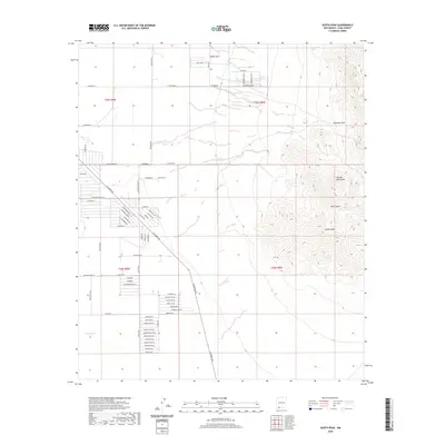
2020 Map of South Peak
USGS Topo · Published 2020About this map
The Florida Mountains dominate the eastern half of this terrain, anchored by the high point of South Peak and the nearby Box Canyon. This arid landscape shows a distinct transition from high peaks to the desert floor, where an expansive network of rural roads and residential tracts has emerged. The small settlement of White Hills sits near the northern boundary, while the area around Mahoney Park and Mahoney Park Rd reflects localized land development. The western reaches are characterized by a grid of long desert roads such as McCan Rd Se and Columbus Rd, leading toward more concentrated street naming in the south. These southern sectors, divided by Espejo Ave, feature a series of streets named for Central and South American countries and historical figures, indicating modern suburban-style planning in a traditional ranching environment. Water is a critical and scarce resource here, marked only by isolated features like Palayo Tank on the western flats.
Find a feature on this map
67 named features on this map. Tap any name to fly to it.
Don’t see what you’re looking for? This feature index may not catch every label — zoom into the map to look around manually.
Map Details
Editions of this 2020 South Peak Map
This is the sole edition of this map. No revisions or reprints were ever made.
Other maps of this area

1899 · Deming
USGS Topo · 1:125,000

1915 · Deming
USGS Topo · 1:125,000

1917 · Hermanas
USGS Topo · 1:62,500

1917 · Columbus
USGS Topo · 1:62,500

1918 · Columbus
USGS Topo · 1:62,500

1918 · Hermanas
USGS Topo · 1:62,500

1920 · Columbus
USGS Topo · 1:62,500

1943 · Hermanas
USGS Topo · 1:62,500

1953 · El Paso
USGS Topo · 1:250,000

1955 · Las Cruces
USGS Topo · 1:250,000