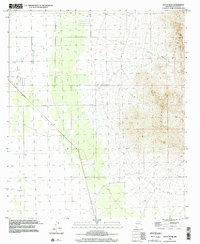
1996 Map of South Peak
USGS Topo · Published 2002About this map
The Florida Mountains dominate the eastern landscape of this New Mexico quadrangle, rising sharply toward the prominent South Peak. This desert terrain is defined by its water management and extraction history, with numerous wells and the Mc Bee Windmill scattered across the basin floor. Small-scale industrial activity is evident in the cluster of Sandpits and Gravel Pits found near the base of the mountains.
Find a feature on this map
18 named features on this map. Tap any name to fly to it.
Don’t see what you’re looking for? This feature index may not catch every label — zoom into the map to look around manually.
Map Details
Editions of this 1996 South Peak Map
This is the sole edition of this map. No revisions or reprints were ever made.
Other maps of this area

1899 · Deming
USGS Topo · 1:125,000

1915 · Deming
USGS Topo · 1:125,000

1917 · Hermanas
USGS Topo · 1:62,500

1917 · Columbus
USGS Topo · 1:62,500

1918 · Columbus
USGS Topo · 1:62,500

1918 · Hermanas
USGS Topo · 1:62,500

1920 · Columbus
USGS Topo · 1:62,500

1943 · Hermanas
USGS Topo · 1:62,500

1953 · El Paso
USGS Topo · 1:250,000

1955 · Las Cruces
USGS Topo · 1:250,000