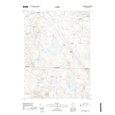
2018 Map of South Sandisfield
USGS Topo · Published 2018About this map
The Umpachene River and Whiting River flow through this upland region straddling the Massachusetts-Connecticut border, connecting the villages of New Marlborough and Sandisfield. The landscape is defined by its numerous water bodies and wetlands, including the Thousand Acre Swamp Reservoir and the tranquil York Lake. Small rural settlements like Southfield and Konkapot are linked by a network of historic roads such as Canaan Southfield Rd and New Hartford Rd.
Find a feature on this map
100 named features on this map. Tap any name to fly to it.
Don’t see what you’re looking for? This feature index may not catch every label — zoom into the map to look around manually.
Map Details
Editions of this 2018 South Sandisfield Map
This is the sole edition of this map. No revisions or reprints were ever made.
Other maps of this area

1885 · Sheffield
USGS Topo · 1:62,500

1888 · Sheffield
USGS Topo · 1:62,500

1888 · Sandisfield
USGS Topo · 1:62,500

1891 · Sheffield
USGS Topo · 1:62,500

1892 · Winsted
USGS Topo · 1:62,500

1892 · Cornwall
USGS Topo · 1:62,500

1893 · Sheffield
USGS Topo · 1:62,500

1893 · Cornwall
USGS Topo · 1:62,500

1893 · Sandisfield
USGS Topo · 1:62,500

1897 · Sandisfield
USGS Topo · 1:62,500