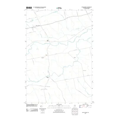
2011 Map of South Sebec
USGS Topo · Published 2011About this map
South Sebec and the neighboring hamlets of Atkinson Corners and Atkinson Mills anchor this landscape along the winding course of the Piscataquis River. This interior region of Piscataquis County is defined by a dense network of watercourses, including the meandering Alder Stream, Meadow Brook, and Brown Brook, which feed into the larger river system. For family historians, the area is well-marked with burial grounds such as Sebec Corner Cemetery, North Atkinson Cemetery, and Hart Cemetery, reflecting generations of settlement in these small crossroads communities. The road network, featuring routes like E Dover Rd and N Stagecoach Rd, connects these dispersed rural clusters through a terrain of low-lying ponds and marshes, including Dow Pond and Parker Pond.
Find a feature on this map
42 named features on this map. Tap any name to fly to it.
Don’t see what you’re looking for? This feature index may not catch every label — zoom into the map to look around manually.
Map Details
Editions of this 2011 South Sebec Map
This is the sole edition of this map. No revisions or reprints were ever made.
Other maps of this area

1932 · Dover-Foxcroft
USGS Topo · 1:48,000

1933 · Boyd Lake
USGS Topo · 1:62,500

1935 · Dover-Foxcroft
USGS Topo · 1:62,500

1940 · Sebec
USGS Topo · 1:48,000

1943 · Sebec
USGS Topo · 1:62,500

1947 · Schoodic
USGS Topo · 1:62,500

1949 · Schoodic
USGS Topo · 1:62,500

1951 · Boyd Lake
USGS Topo · 1:50,000

1954 · Millinocket
USGS Topo · 1:250,000

1955 · Boyd Lake
USGS Topo · 1:62,500