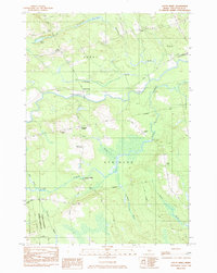
1983 Map of South Sebec
USGS Topo · Published 1984About this map
The Piscataquis River cuts through the heart of this central Maine landscape, defining the border between the townships of Sebec and Atkinson. By the early 1980s, the region retained its traditional rural character, anchored by small crossroads such as Sebec Corners and Atkinson Corners. The map documents a significant network of local history, including the Atkinson Ch and Atkinson Sch, alongside several family and community burial grounds like North Atkinson Cem and Gould Cem. Industrial and social history is visible in the placement of Atkinson Mills and an old RR Grade that parallels the Bangor & Aroostook Road. The southern portion of the sheet is dominated by the Penobscot-Piscataquis Wildlife Management Area, where the drainage of Alder Stream and Levenseller Brook create a complex system of wetlands and meadows.
Find a feature on this map
41 named features on this map. Tap any name to fly to it.
Don’t see what you’re looking for? This feature index may not catch every label — zoom into the map to look around manually.
Map Details
Editions of this 1983 South Sebec Map
This is the sole edition of this map. No revisions or reprints were ever made.
Other maps of this area

1932 · Dover-Foxcroft
USGS Topo · 1:48,000

1933 · Boyd Lake
USGS Topo · 1:62,500

1935 · Dover-Foxcroft
USGS Topo · 1:62,500

1940 · Sebec
USGS Topo · 1:48,000

1943 · Sebec
USGS Topo · 1:62,500

1947 · Schoodic
USGS Topo · 1:62,500

1949 · Schoodic
USGS Topo · 1:62,500

1951 · Boyd Lake
USGS Topo · 1:50,000

1954 · Millinocket
USGS Topo · 1:250,000

1955 · Boyd Lake
USGS Topo · 1:62,500