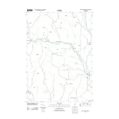
2012 Map of South Strafford
USGS Topo · Published 2012About this map
The W Br Ompompanoosuc River and its larger parent stream, the Ompompanoosuc River, anchor this landscape of eastern Vermont. In the early 2010s, this area remained defined by its small crossroads settlements and agricultural hills, including the communities of South Strafford and Union Village. The map details the rural infrastructure of the region, from the Thetford Center Covered Bridge in the northeast to the Union Village Covered Bridge further south. Local history is preserved in numerous family and settlement cemeteries, such as the Sawnee Bean Cem, Clough Cem, and Jackman Cem, which sit alongside historic road names like Pero Hill Rd and Poor Farm Rd. Names like Copperas Hill and Copper Flat hint at the area's geological and industrial past, while high points like Gile Mountain and Morrill Mountain provide the topographic structure for the many brooks that feed the Ompompanoosuc watershed.
Find a feature on this map
112 named features on this map. Tap any name to fly to it.
Don’t see what you’re looking for? This feature index may not catch every label — zoom into the map to look around manually.
Map Details
Editions of this 2012 South Strafford Map
This is the sole edition of this map. No revisions or reprints were ever made.
Other maps of this area

1896 · Strafford
USGS Topo · 1:62,500

1906 · Hanover
USGS Topo · 1:62,500

1908 · Hanover
USGS Topo · 1:62,500

1927 · Mascoma
USGS Topo · 1:62,500

1931 · Mt. Cube
USGS Topo · 1:62,500

1932 · Mascoma
USGS Topo · 1:62,500

1933 · Mt. Cube
USGS Topo · 1:62,500

1944 · Strafford
USGS Topo · 1:62,500

1950 · Glens Falls
USGS Topo · 1:250,000

1956 · Glens Falls
USGS Topo · 1:250,000