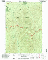
1995 Map of South Twin Mountain
USGS Topo · Published 2000About this map
White Mountain National Forest dominates this mid-1990s survey, showing a landscape defined by its high-altitude peaks and a sophisticated network of backcountry infrastructure. The terrain is anchored by several prominent summits including South Twin Mountain, Mount Garfield, and Mount Guyot, while the Appalachian National Scenic Trail winds across the high ridges. This era of the forest is characterized by managed hiker resources, from the Galehead Hut and Garfield Ridge Shelter to the Tent Platforms near Thirteen Falls.
Find a feature on this map
51 named features on this map. Tap any name to fly to it.
Don’t see what you’re looking for? This feature index may not catch every label — zoom into the map to look around manually.
Map Details
Editions of this 1995 South Twin Mountain Map
This is the sole edition of this map. No revisions or reprints were ever made.
Other maps of this area

1893 · Mt. Washington
USGS Topo · 1:62,500

1895 · Crawford Notch
USGS Topo · 1:62,500

1896 · Mt. Washington
USGS Topo · 1:62,500

1896 · Crawford Notch
USGS Topo · 1:62,500

1900 · Whitefield
USGS Topo · 1:62,500

1929 · Franconia
USGS Topo · 1:62,500

1932 · Franconia
USGS Topo · 1:62,500

1935 · Whitefield
USGS Topo · 1:48,000

1935 · Mt. Washington
USGS Topo · 1:62,500
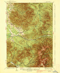
1938 · Mt. Washington
USGS Topo · 1:62,500