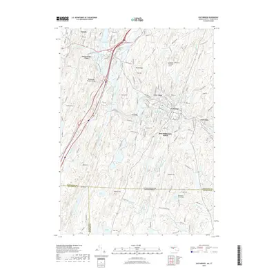
2018 Map of Southbridge
USGS Topo · Published 2018About this map
Southbridge and the surrounding Worcester County countryside appear here along the winding course of the Quinebaug River. This region is defined by its early industrial character and historic preservation, notably featuring the expansive living history museum at Old Sturbridge Village. The river system, which includes Westville Lake and Number One Reservoir, historically powered the local manufacturing centers of Globe Village and Sandersdale. Further south, the landscape transitions into a more rural character as it crosses the state line into Connecticut, near Hatchet Pond and Muddy Pond. The map provides significant detail for genealogists, documenting several local burial grounds including Oak Ridge Cem and Saint Marys Cem. From the summit of Leadmine Mtn to the bustling corridors of Main St, the map reflects a balance between the developed urban core of Southbridge Town and the outlying hills of the New England upland.
Find a feature on this map
66 named features on this map. Tap any name to fly to it.
Don’t see what you’re looking for? This feature index may not catch every label — zoom into the map to look around manually.
Map Details
Editions of this 2018 Southbridge Map
This is the sole edition of this map. No revisions or reprints were ever made.
Other maps of this area

1887 · Brookfield
USGS Topo · 1:62,500

1889 · Webster
USGS Topo · 1:62,500

1889 · Putnam
USGS Topo · 1:62,500

1890 · Brookfield
USGS Topo · 1:62,500

1892 · Woodstock
USGS Topo · 1:62,500

1892 · Webster
USGS Topo · 1:62,500

1893 · Putnam
USGS Topo · 1:62,500

1893 · Brookfield
USGS Topo · 1:62,500

1908 · Quinsigamond
USGS Topo · 1:125,000

1908 · Ware
USGS Topo · 1:125,000