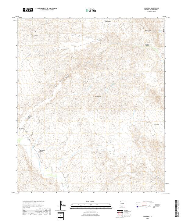
2021 Map of Soza Mesa
USGS Topo · Published 2021About this map
Soza Mesa rises as a prominent landform above the San Pedro River valley in this 2021 topographical survey of Cochise County. The landscape is defined by its drainage systems, where intermittent flows like Teran Wash and Pool Wash carve deep channels through the arid terrain. The presence of named water sources such as Wildcat Spring, Sierra Blanca Spring, and Hackberry Spring suggests the vital importance of reliable water in this desert environment.
Find a feature on this map
36 named features on this map. Tap any name to fly to it.
Don’t see what you’re looking for? This feature index may not catch every label — zoom into the map to look around manually.
Map Details
Editions of this 2021 Soza Mesa Map
This is the sole edition of this map. No revisions or reprints were ever made.
Other maps of this area

1943 · Dragoon
USGS Topo · 1:62,500

1943 · Winchester Mts.
USGS Topo · 1:62,500

1945 · Redington
USGS Topo · 1:62,500

1945 · Winchester Mts.
USGS Topo · 1:62,500

1945 · Happy Valley
USGS Topo · 1:62,500

1956 · Tucson
USGS Topo · 1:250,000

1957 · Redington
USGS Topo · 1:62,500

1957 · Winchester Mts.
USGS Topo · 1:62,500

1958 · Tucson
USGS Topo · 1:250,000

1958 · Happy Valley
USGS Topo · 1:62,500