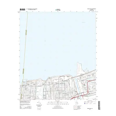
2015 Map of Spanish Fort
USGS Topo · Published 2015About this map
The northern edge of New Orleans meets the vast expanse of Lake Pontchartrain in this detailed 2015 layout, documenting a landscape defined by its complex water management and suburban density. From the historic Spanish Fort area to the mid-century developments of Gentilly Terrace and Gentilly Woods, the map illustrates a city structured around its drainage and navigation infrastructure, including the 17th Street Canal and the massive Inner Harbor Navigation Canal. Education and recreation anchor the lakefront, with the Univ of New Orleans and Southern Univ at New Orleans campuses situated near the former Pontchartrain Beach. This map is particularly valuable for its recording of institutional landmarks like the New Orleans Baptist Theological Seminary and the Ahavas Sholem Cem, offering a clear view of the residential and commercial fabric of neighborhoods such as Lakeview and Milneburg in the 21st century.
Find a feature on this map
41 named features on this map. Tap any name to fly to it.
Don’t see what you’re looking for? This feature index may not catch every label — zoom into the map to look around manually.
Map Details
Editions of this 2015 Spanish Fort Map
This is the sole edition of this map. No revisions or reprints were ever made.
Other maps of this area

1891 · Spanish Fort
USGS Topo · 1:62,500

1891 · New Orleans
USGS Topo · 1:62,500

1892 · Chef Menteur
USGS Topo · 1:62,500

1892 · St. Bernard
USGS Topo · 1:62,500

1932 · New Orleans NE
USGS Topo · 1:31,680

1932 · New Orleans NW
USGS Topo · 1:31,680

1936 · South Point
USGS Topo · 1:31,680

1936 · Chef Menteur
USGS Topo · 1:62,500

1936 · Spanish Fort
USGS Topo · 1:62,500

1938 · Little Woods
USGS Topo · 1:31,680