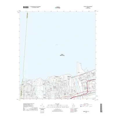
2018 Map of Spanish Fort
USGS Topo · Published 2018About this map
Lake Pontchartrain dominates the northern horizon of this coastal New Orleans landscape, where water management infrastructure and historical neighborhoods define the city's edge. The map captures the engineered interface of the Inner Harbor Navigation Canal and the London Avenue Outfall Canal, framing residential districts like Milneburg and Gentilly Terrace. Significant cultural and educational institutions are established here, including the Univ of New Orleans and the New Orleans Baptist Theological Seminary. Along the southern margin, a cluster of burial grounds including Hebrew Rest Cem, Beth Israel Cem, and Ahavas Sholem Cem provides a focal point for genealogical interest. The transition from the lakefront at Pontchartrain Beach to the established grid of West End illustrates the density of the 21st-century city, while the Theard Memorial Bridge connects the developed shoreline to the interior bayous and canals that have long shaped the region's geography.
Find a feature on this map
79 named features on this map. Tap any name to fly to it.
Don’t see what you’re looking for? This feature index may not catch every label — zoom into the map to look around manually.
Map Details
Editions of this 2018 Spanish Fort Map
This is the sole edition of this map. No revisions or reprints were ever made.
Other maps of this area

1891 · Spanish Fort
USGS Topo · 1:62,500

1891 · New Orleans
USGS Topo · 1:62,500

1892 · Chef Menteur
USGS Topo · 1:62,500

1892 · St. Bernard
USGS Topo · 1:62,500

1932 · New Orleans NE
USGS Topo · 1:31,680

1932 · New Orleans NW
USGS Topo · 1:31,680

1936 · South Point
USGS Topo · 1:31,680

1936 · Chef Menteur
USGS Topo · 1:62,500

1936 · Spanish Fort
USGS Topo · 1:62,500

1938 · Little Woods
USGS Topo · 1:31,680