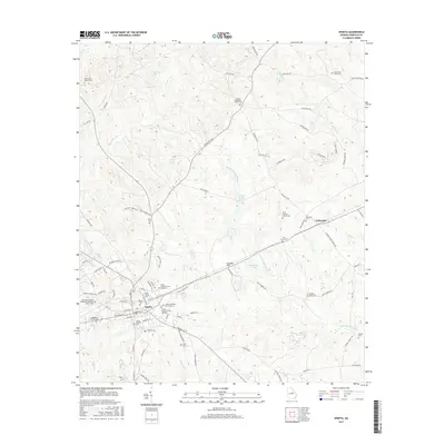
2017 Map of Sparta
USGS Topo · Published 2017About this map
The Hancock County seat of Sparta serves as the focal point for this survey of the Georgia Piedmont, showing the town's historic street grid and central administrative core. The landscape is defined by the headwaters of the Little Ogeechee River and its various tributaries like Beaverdam Cr, which once powered the local economy. A high concentration of family and denominational burial grounds, such as the Holsey Memorial Cem Number 1, Dixon Family Cem, and Sparta Catholic Cem, suggests a long-established pattern of settlement and local genealogy.
Find a feature on this map
102 named features on this map. Tap any name to fly to it.
Don’t see what you’re looking for? This feature index may not catch every label — zoom into the map to look around manually.
Map Details
Editions of this 2017 Sparta Map
This is the sole edition of this map. No revisions or reprints were ever made.
Other maps of this area

1912 · Milledgeville
USGS Topo · 1:62,500

1953 · Athens
USGS Topo · 1:250,000

1958 · Athens
USGS Topo · 1:250,000

1959 · Athens
USGS Topo · 1:250,000

1960 · Warthen NE
USGS Topo · 1:24,000

1961 · Warthen NW
USGS Topo · 1:24,000

1963 · Athens
USGS Topo · 1:250,000

1972 · Shoulderbone
USGS Topo · 1:24,000

1972 · Sparta NW
USGS Topo · 1:24,000
1972 · Jewell
USGS Topo · 1:24,000