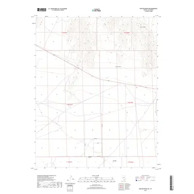
2018 Map of Specter Range SW
USGS Topo · Published 2018About this map
The Specter Range dominates the northern horizon of this landscape, marking a stark transition into the Mojave Desert and the Amargosa Desert. Located in Nye County, this area captures a moment of modern desert settlement organized around a distinct grid of residential roads. The small community of Crystal serves as a focal point in the southern portion of the quadrangle, where a cluster of named streets like Laurel Way and Steir St indicates localized development amidst the arid flats. This transition from high-elevation ridgelines to the structured township of Crystal reflects the enduring pattern of human habitation in the Great Basin, where transportation corridors like the Crystal Hwy and White Blvd connect remote outposts to the broader region.
Find a feature on this map
16 named features on this map. Tap any name to fly to it.
Don’t see what you’re looking for? This feature index may not catch every label — zoom into the map to look around manually.
Map Details
Editions of this 2018 Specter Range SW Map
This is the sole edition of this map. No revisions or reprints were ever made.
Other maps of this area

1908 · Furnace Creek
USGS Topo · 1:250,000

1910 · Furnace Creek
USGS Topo · 1:250,000

1942 · Skull Mountain
USGS Topo · 1:125,000

1948 · Death Valley
USGS Topo · 1:250,000

1952 · Ash Meadows
USGS Topo · 1:62,500

1952 · Specter Range
USGS Topo · 1:62,500

1954 · Death Valley
USGS Topo · 1:250,000

1956 · Death Valley
USGS Topo · 1:250,000

1957 · Death Valley
USGS Topo · 1:250,000

1958 · Death Valley
USGS Topo · 1:250,000