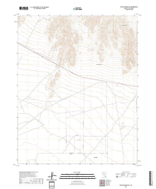
2021 Map of Specter Range SW
USGS Topo · Published 2021About this map
The Amargosa Desert and the Mojave Desert converge in this arid section of Nye County, where the topography is defined by the stark southern slopes of the Specter Range. Near the southern boundary, the settlement of Crystal serves as a modern focal point, situated at the junction of Crystal Hwy and Laurel Way. The transition from the rugged mountain slopes in the north to the broad desert floor is bisected by Highway 95, which cuts diagonally across the landscape. A developing residential grid is evident south of the Specter Range, with named thoroughfares like White Blvd, Weston Dr, and Steir St indicating localized land use patterns within this vast desert environment.
Find a feature on this map
17 named features on this map. Tap any name to fly to it.
Don’t see what you’re looking for? This feature index may not catch every label — zoom into the map to look around manually.
Map Details
Editions of this 2021 Specter Range SW Map
This is the sole edition of this map. No revisions or reprints were ever made.
Other maps of this area

1908 · Furnace Creek
USGS Topo · 1:250,000

1910 · Furnace Creek
USGS Topo · 1:250,000

1942 · Skull Mountain
USGS Topo · 1:125,000

1948 · Death Valley
USGS Topo · 1:250,000

1952 · Ash Meadows
USGS Topo · 1:62,500

1952 · Specter Range
USGS Topo · 1:62,500

1954 · Death Valley
USGS Topo · 1:250,000

1956 · Death Valley
USGS Topo · 1:250,000

1957 · Death Valley
USGS Topo · 1:250,000

1958 · Death Valley
USGS Topo · 1:250,000