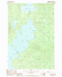
1989 Map of Spencer Bay
USGS Topo · Published 1989About this map
Spencer Bay dominates this late-twentieth-century landscape where the waters of Moosehead Lake meet the northern Maine woods. The map details a transition between protected grants and wilderness recreation, featuring significant water bodies like Spencer Pond and the Roach River. Land divisions such as the East Middlesex Canal Grant and Days Academy Grant provide historical context for the region's land ownership and management.
Find a feature on this map
27 named features on this map. Tap any name to fly to it.
Don’t see what you’re looking for? This feature index may not catch every label — zoom into the map to look around manually.
Map Details
Editions of this 1989 Spencer Bay Map
This is the sole edition of this map. No revisions or reprints were ever made.
Other maps of this area

1920 · Moosehead Lake
USGS Topo · 1:62,500

1922 · Moosehead Lake
USGS Topo · 1:62,500

1930 · Moosehead Lake
USGS Topo · 1:62,500

1944 · Moosehead Lake
USGS Topo · 1:62,500

1952 · First Roach Pond
USGS Topo · 1:62,500

1954 · North East Carry
USGS Topo · 1:62,500

1954 · Grant Farm
USGS Topo · 1:62,500

1954 · Millinocket
USGS Topo · 1:250,000

1957 · Moosehead Lake
USGS Topo · 1:62,500

1958 · Millinocket
USGS Topo · 1:250,000
Featured Places
- Days Academy Grant Township, ME
- Spencer Bay Township, ME
- Lily Bay Township, ME
- East Middlesex Canal Grant Township, ME
- Piscataquis County, ME