2022 Map of Sperry
USGS Topo · Published 2022About this map
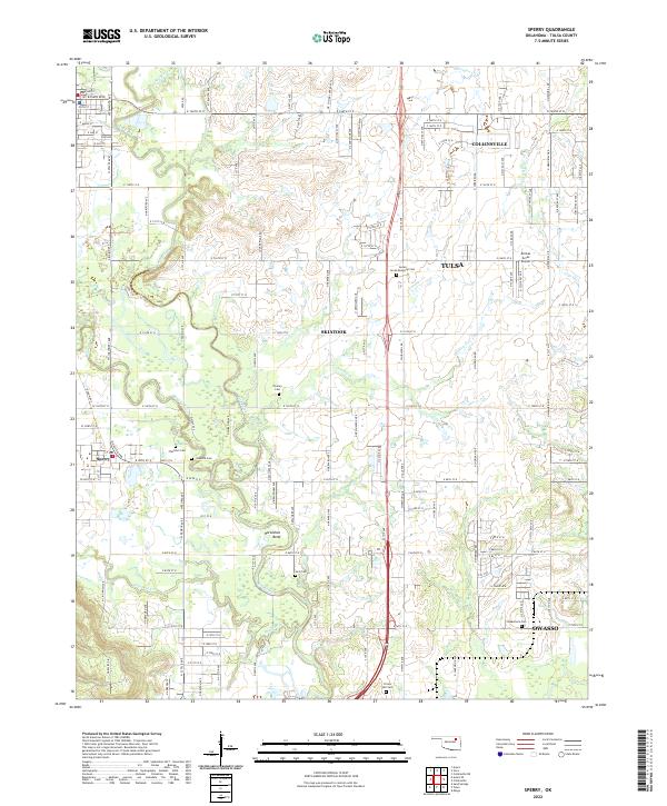
Sperry sits at the heart of this Oklahoma landscape, where the meandering path of Hominy Creek winds through the southwestern quadrant. The terrain is defined by a complex network of waterways, including the broad Bird Creek and the distinctive Horseshoe Bend near the center of the survey. As the suburban expansion of Tulsa and Owasso presses in from the south and east, many small family and community burial grounds remain preserved across the landscape. These sites, such as Chisholm Cem, Skybuck Cem, and Lord Cem, provide significant markers for genealogical research in an area once largely defined by its creek-bottom geography. In the northeast, the growth of Collinsville and Skiatook bookends a region that maintains its rural character through aviation landmarks like Airman Acres Airport, even as modern arterial roads like WC Rogers Blvd facilitate local transit.
Find a feature on this map
69 named features on this map. Tap any name to fly to it.
Don’t see what you’re looking for? This feature index may not catch every label — zoom into the map to look around manually.
Map Details
Editions of this 2022 Sperry Map
This is the sole edition of this map. No revisions or reprints were ever made.