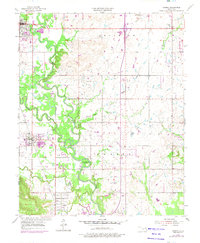
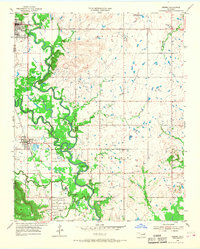
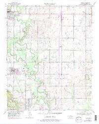
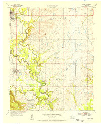
1955 Map of Sperry
USGS Topo · Published 1975About this map
Bird Creek and Hominy Creek converge in this northern Oklahoma landscape, where the winding water courses define the boundary between Osage Co and Tulsa Co. The settlement of Skiatook sits in the northwest corner, while Sperry and Turley are situated further south along the Texas and Pacific rail line. The presence of numerous petroleum features, including Oil Tanks, a Gas Well, and various clusters of Oil Wells, highlights the region's mid-century energy production.
Find a feature on this map
29 named features on this map. Tap any name to fly to it.
Don’t see what you’re looking for? This feature index may not catch every label — zoom into the map to look around manually.
Map Details
Editions of this 1955 Sperry Map
4 editions found
Other maps of this area

1901 · Claremore
USGS Topo · 1:125,000

1912 · Hominy
USGS Topo · 1:125,000

1914 · Claremore
USGS Topo · 1:125,000

1915 · Hominy
USGS Topo · 1:125,000

1916 · Claremore
USGS Topo · 1:125,000

1954 · Tulsa
USGS Topo · 1:250,000

1954 · Tulsa
USGS Topo · 1:24,000
1955 · Sperry
USGS Topo · 1:24,000

1955 · Mingo
USGS Topo · 1:24,000

1955 · Enid
USGS Topo · 1:250,000